Sligo Way
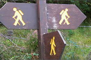
About
Taking three days to complete, this linear trail connects Ballyconnellan, County Sligo with Dromahair, County Leitrim and showcases magnificent Wild Atlantic Way scenery along the way.
The Sligo Way treats walkers to unparalleled vistas in the east over to Ben Bulben, north across Donegal Bay to Sliabh Liag and west to the Nephin Mountain range from the high moorland in the Ox Mountains. Towards the trail’s end, you’ll enjoy pleasant woodland and lakeside stretches too.
The terrain of this moderate 80km route consists mainly of forest tracks and ride lines, quiet side roads, and open moorland paths - often wet and boggy in places.
The Sligo Way has no significant climbs, with the entire route’s aggregate ascent only 900m. There are no accommodation options available for about the first 40km of the route, but plenty thereafter.
Location Information
Address
Bunnyconnellan West, Bunnyconnellan, Co. Mayo, Ireland